Page 66 - LIT-18626-15-21
P. 66

UF7K11E0.book  Page 54  Monday, June 17, 2024  7:03 PM


                        Instrument operation

                         The “    ” function can also be activated  To add a track using the “  ”
                          by selecting a waypoint “  ” displayed on  function:
                          the map screen.                     (1) Select “ ” on the “       ”.

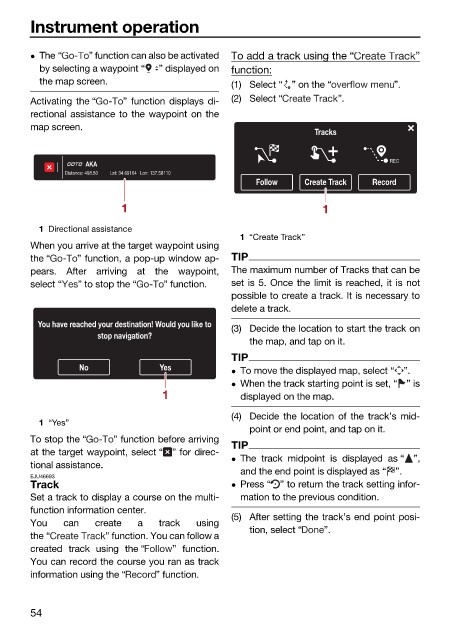
                        Activating the “  ” function displays di-  (2) Select “   ”.
                        rectional assistance to the waypoint on the
                        map screen.
                                                                             Tracks

                                                                                           REC
                                   AKA
                               Distance: 498.50  Lat: 34.69164 Lon: 137.58110
                                                                  Follow   Create Track  Record
                                         1                                     1

                          1 Directional assistance
                                                               1 “Create Track”
                        When you arrive at the target waypoint using
                        the “    ” function, a pop-up window ap-  TIP
                        pears. After arriving at the  waypoint,  The maximum number of Tracks that can be
                        select “  ” to stop the “  ” function.  set is 5. Once the limit is reached, it is not
                                                              possible to create a track. It is necessary to
                                                              delete a track.
                          You have reached your destination! Would you like to  (3) Decide the location to start the track on
                                     stop navigation?
                                                                 the map, and tap on it.
                                                              TIP
                                 No             Yes            To move the displayed map, select “ ”.
                                                               When the track starting point is set, “ ” is
                                                 1             displayed on the map.
                                                              (4) Decide the location of the track’s mid-
                          1 “Yes”
                                                                 point or end point, and tap on it.
                        To stop the “   ” function before arriving
                                                              TIP
                        at the target waypoint, select “ ” for direc-
                                                               The track midpoint is  displayed as “ ”,
                        tional assistance.
                                                               and the end point is displayed as “ ”.
                        EJU46693
                        Track                                  Press “ ” to return the track setting infor-
                        Set a track to display a course on the multi-  mation to the previous condition.
                        function information center.
                                                              (5) After setting the track’s end point posi-
                        You   can   create  a   track  using
                                                                 tion, select “  ”.
                        the “         ” function. You can follow a
                        created track using the “  ” function.
                        You can record the course you ran as track
                        information using the “  ” function.


                        54
   61   62   63   64   65   66   67   68   69   70   71