


Page 80 - LIT-18626-15-20
P. 80
UF3X16E0.book Page 68 Wednesday, July 17, 2024 9:11 AM
Instrument operation
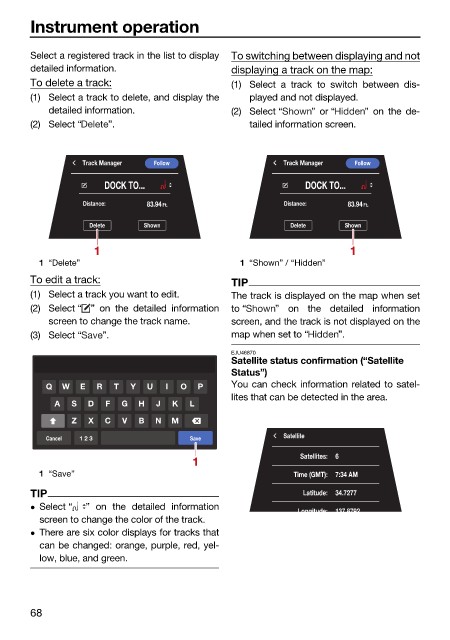
Select a registered track in the list to display To switching between displaying and not
detailed information. displaying a track on the map:
To delete a track: (1) Select a track to switch between dis-
(1) Select a track to delete, and display the played and not displayed.
detailed information. (2) Select “ ” or “ ” on the de-
(2) Select “ ”. tailed information screen.
Track Manager Follow Track Manager Follow
DOCK TO... DOCK TO...
Distance: 83.94 Ft. Distance: 83.94 Ft.
Delete Shown Delete Shown
1 1
1 “Delete” 1 “Shown” / “Hidden”
To edit a track: TIP
(1) Select a track you want to edit. The track is displayed on the map when set
(2) Select “ ” on the detailed information to “ ” on the detailed information
screen to change the track name. screen, and the track is not displayed on the
(3) Select “ ”. map when set to “ ”.
EJU46870
Satellite status confirmation (“Satellite
Status”)
Q W E R T Y U I O P You can check information related to satel-
lites that can be detected in the area.
A S D F G H J K L
Z X C V B N M
Cancel 1 2 3 Save Satellite
1 Satellites: 6
1 “Save” Time (GMT): 7:34 AM
TIP Latitude: 34.7277
Select “ ” on the detailed information Longitude: 137 8792
screen to change the color of the track.
There are six color displays for tracks that
can be changed: orange, purple, red, yel-
low, blue, and green.
68

